


LiDAR Experts in Germany
for accurate 3D data, matched in minutes with the power of AIHire experts who process point clouds, design mobile mapping workflows and connect LiDAR data with GIS, robotics or autonomous systems. FRATCH finds the right vetted, available freelancers through fast, precise AI matching.

Meet FRATCH Experts in Germany, who have recently used LiDAR
Thorsten H.
Last position:
Product Owner, Software Developer, AI Manager, Technical Consultant at crazyALEX.de GmbH
AI-supported document processing and inventory management integration
Design and development of an AI-supported application for the automated processing of delivery and invoice documents, connected to SelectLine ERP. Documents are analyzed using AI, matched with orders and line items, and prepared for posting goods receipts.
IMPACT:
- Automated extraction of structured order, delivery and invoice data from PDF and image documents
- Automatic and manual mapping of documents to orders and order line items
- Integration with SelectLine ERP for order import, status synchronization and goods receipt postings
- Traceable processing through separate analysis, mapping and posting processes as well as technical logging
- Development of a containerized end-to-end architecture with AI analysis, workflow automation and relational data storage
KEYWORDS: AI, document analysis, OpenAI, n8n, SelectLine ERP, FastAPI, Python, JavaScript, MariaDB, Docker, REST API, PDF, OCR, mapping, inventory management, goods receipt, workflow automation
Peter S.
Last position:
Senior ML Engineer & AI Researcher at Anonymous Client
Project: Defect Generation on Test-Bench Images of Metal Surfaces Environment: Automated Visual Inspection (AVI), Metallurgy & Manufacturing
- Objective & Implementation: Designed, architected, and trained Generative Adversarial Networks (Pix2PixHD / SPADE) for image-to-image transformation. Targeted generation of synthetic material defects (e.g., cracks, inclusions, scale) on rough metal surfaces under real test-bench lighting conditions for privacy-compliant and efficient dataset expansion (data augmentation).
- Technical Design: Implemented robust Generative AI and computer vision pipelines in Python and PyTorch. Used semantic segmentation approaches for mask-controlled defect synthesis and subsequent evaluation with EfficientDet object detection models.
- Business Impact: Massive dataset upscaling (10x) without time-consuming and costly physical test-bench runs, while significantly improving the detection performance of automated inspection systems.
Technologies & Skills Used: Python | PyTorch | SPADE | Pix2PixHD | EfficientDet | Machine Learning | Semantic Segmentation | Computer Vision
Muhammad Tanveer B.
Last position:
Embedded Systems Consultant / Architect | Integration and Validation Engineer / Manager at Ingenieurbüro Baig
Led the hardware development and validation of a safety-critical 400-V battery management system (BMS) for the TOGG SUV program; performed system architecture reviews, schematic validations, EMC and reliability tests, and root cause analyses in compliance with relevant automotive standards (ECE-R10, CISPR25, ISO-26262). Coordinated cross-country EU engineering teams, customer reviews, and technical documentation to deliver a production-ready, validated system.
Architected and integrated 22 state-of-the-art ADAS validation vehicles for BMW ADCAM and LIDAR programs at Magna Electronics; synchronized up to 26 heterogeneous sensors (LIDAR, RADAR, cameras, GNSS/INS) using PTP-based timing architectures. Defined the system architecture, HW/SW interfaces for hardware-in-the-loop (HIL) rework, sensor integration strategies, and data acquisition frameworks. This enabled scalable vehicle-level validation, improved validation efficiency by 25%, and reduced project costs by €1.45 million.
End-to-end validation and integration of automotive radar platforms for a Daimler project at Continental. Developed automated open-loop hardware-in-the-loop (HIL) environments to accurately test target tracking KPIs, field-of-view limits, and thermal and voltage-related ECU state machines. Skilled use of a highly complex toolchain consisting of CANoe, Lauterbach Trace32, RADAR target simulators, and EMC shielding chambers for RF and system validation. Synchronized global, interdisciplinary teams to speed up troubleshooting and close critical technical gaps.
Reconstructed and validated the product architecture of an electromechanical e-bike by integrating and troubleshooting critical subsystems (BMS, motor control, sensors, HMI, electronic locking systems). Built a comprehensive system-level test bench for functional testing, fault reproduction, and performance analysis; coordinated suppliers and implemented corrective actions to improve reliability and traceability.
Defined the system architecture and validation strategy for a LIDAR platform developed in cooperation with Elmos Semiconductor; evaluated optical measurement concepts, SPAD detector integration, and system requirements, and created technical recommendations for product development and verification.
Developed LabVIEW-based automation and verification software for a high-precision hydraulic and electromechanical test system for FTE Automotive; integrated NI DAQ hardware for high-frequency real-time capture of physical measurements. Developed automated test sequences, programmable endurance tests, troubleshooting routines, data logging, and analysis tools to improve test efficiency and traceability.
Successfully delivered full engineering life cycles for well-known industrial customers (Magna, Continental, Farasis, FTE Automotive, BMW, Daimler, TOGG) – from requirements engineering and proof of concept to system integration and validation, technical documentation, supplier coordination, and user training.
Felix S.
Last position:
App Developer at XIXUM-Modeler
- Developing a model-based AI where natural language is interpreted as formal relations.
- Natural language terms are not considered rigid but fluid and can be negotiated in a context so meaning resolves by iteratively specifying.
- Develops all kinds of model solutions.
- Backed by natural language and data annotation.
- Requirements to code and other solutions.
Andre K.
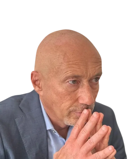
Last position:
Nearshore Engagement Manager at EnBW AG
- Building strong awareness within the company around nearshoring
- Engagement Manager in the Nearshore Competence Center
- Responsible for nearshore consulting, partner screening and technical onboarding, designing and implementing cooperation scenarios, change management, stakeholder management, participation in steering committees, and collaboration with IT and business units
- Tools used: Microsoft Office 365, Microsoft Teams, Azure Devops, Microsoft Sharepoint, Conceptboard
- Key results: Establishment of a nearshoring strategy, successful identification and implementation of outsourcing partnerships, delivery of change management and stakeholder management at the highest level
Arash K.

Last position:
Global Digital Product Manager, IoT Services at Pfeiffer Vacuum GmbH
- Responsibility for the further development of digital service products with a focus on customer value, profitability, and scalable growth
- Development and prioritization of the service product roadmap based on customer feedback, market analysis, financial evaluation, and technical feasibility
- Identification of new digital service opportunities as well as derivation of product requirements, feature priorities, and value propositions
- Alignment of product vision, roadmap, and user experience with product owners, center of competence, sales, service, and market organizations
- Support of go-to-market activities, market validations, and internal training for the successful launch of digital service offerings
- Use of data-based decision-making to assess customer needs, business model assumptions, and product progress
Rajan K.
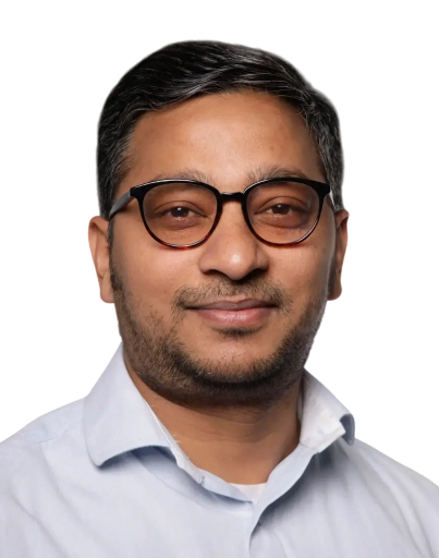
Last position:
Technical Lead/BTV at BMW, Daimler (Mercedes), VW Group, Hella, Ficosa, Cariad (Audi/Porsche/Skoda)
- Directed full lifecycle of embedded software projects including LiDAR, BMS, OCU, and Cybersecurity systems.
- Coordinated internal and external stakeholders including suppliers like Bosch, Bertrandt, Magna, Continental and IAV.
- Managed cross-country teams of 12–15 engineers, conducting project onboarding and role-based training.
- Implemented change control and risk registers for safety-critical automotive platforms.
- Oversaw project schedules using MS Project, JIRA, and Azure DevOps to ensure milestone alignment and transparency.
- Extensive hands-on expertise in test planning and execution for ECUs in compliance with Automotive SPICE (SWE.4–SWE.6) and ISO 26262.
- Led digital transformation project with a cross-functional team of 15+, ensuring successful integration of systems and workflows.
- Maintained project overviews and tracking in tools like Milestones (Daimler) and MS Project, and managed status reporting to senior stakeholders.
- Coordinated with third-party transformation partners and ensured timely delivery of decision templates and risk assessments.
- Applied PRINCE2 methodology for structured delivery; facilitated agile ceremonies and maintained Confluence-based documentation.
- Strong leadership in cross-functional teams and working in agile environments (SAFe, Scrum).
- Successfully led and supported IT and transformation projects, including those in regulated sectors (e.g., KRITIS or energy sector).
- Represented or supported overall project leadership in large-scale transformation programs.
- Maintained and updated complex project plans (Gantt charts, milestone tracking, and resource allocation).
- Coordinated workstreams and interdisciplinary teams; ensured timely delivery of all work packages.
- Acted as central communication point between project team, senior management, external vendors, and transformation partners.
- Prepared and delivered concise status reports, steering committee presentations, and decision memos.
- Identified project risks, maintained risk registers, and led mitigation planning.
- Assessed resource needs and supported reallocation based on project priorities and constraints.
- Proficient in JIRA, Milestones, Confluence, MS Project, MS PowerPoint, and Excel.
- Used both Agile (Scrum) and Waterfall (PRINCE2, PMI) methodologies.
- Created and tracked action lists, meeting protocols, and backlog items.
- Conducted critical analysis of project progress, resource bottlenecks, and deliverable timelines.
- Ensured alignment of transformation goals with enterprise IT architecture and business objectives.
Ananthraj N.

Last position:
Founder at sprhava
Leading the end-to-end development of Edge AI-powered smart glasses for visually impaired individuals, aligning product vision with user needs and managing a cross-functional team of data scientists, Android developers, AWS engineers, and hardware specialists.
- Defined product roadmap for Edge AI smart glasses and MVP features through user research, stakeholder interviews, and competitive analysis, ensuring accessibility and real-world usability.
- Developed and validated a PoC for AI-driven cancer cell identification in PET/CT scans, collaborating with medical experts to optimize diagnostic accuracy and clinical relevance.
- Built and scaled a multidisciplinary team of 75+ engineers, interns, and designers across Germany and India, driving cross-border collaboration and iterative prototyping.
- Established strategic partnerships with NGOs, healthcare providers, and advocacy groups to embed inclusivity and patient feedback into product design.
- Drove hands-on hardware-software integration using Raspberry Pi and Jetson Nano of AI models. Initiated and nurtured relationships with suppliers, manufacturers, and ecosystem players to build scalable go-to-market plans.
- Owned critical product decisions, from prototype development to funding strategy, applying a data-informed and impact-driven mindset.
- Fostered a learning-focused culture by facilitating brainstorming sessions and continuous feedback loops between engineering and product.
Achievements:
- Public speaker: Auto.Ai 2025 (Berlin), Wearable technologies 2025 (Munich and Bangalore), MEDICA 2024 (Dusseldorf)
- WMF, Bologna, Italy (June 2024): Only AI startup to be selected from Germany as EBV hero to represent sprhava on global platform
- Medica, Germany (2024): Delivered a speech on AI smart glasses in world's largest Healthcare event.
- Wearable Technologies, Bengaluru, India (Dec 2024): I was a speaker presenting sprhava and its product.
- Venturise Global Challenge (GIM 2025, Bengaluru Palace, Karnataka): sprhava was selected as one of the 16 top startups (ESDM) to present on this global platform
- Wearable Technologies Conference 2025 EUROPE, Munich, Germany (May 2025): Delivered a talk on Edge AI at the Europe's biggest wearable tech event.
- InsurNext Köln, Germany (2025): sprhava was honoured with a booth from Cologne administration.
André H.

Last position:
Linux IT Admin at ReiserST
- Development and maintenance of IT architectures with embedded Linux systems.
- Designing, implementing, and optimizing backend applications and script-based solutions.
- Analyzing and resolving issues, including troubleshooting and user support.
- Developing and implementing security concepts for cloud solutions.
- Administering networks (DHCP, DNS, NTP, VPN).
- Technologies: Linux, PowerShell, Bash, Python, Ansible, Kubernetes, GitLab CI.
- Methods: Kanban.
Hamza S.
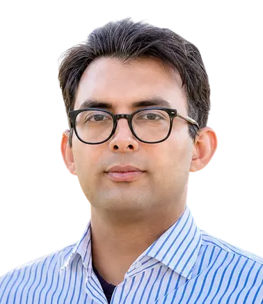
Last position:
Research Associate - AI & Autonomous Systems at Hochschule Coburg
- Developed and implemented AI-based perception and multimodal systems for real-world environments
- Built, trained, and evaluated Machine Learning and Deep Learning models using Python, PyTorch, TensorFlow, and OpenCV
- Worked with Vision-Language Models (VLMs), Large Language Models (LLMs), transformer-based architectures, and multimodal AI systems
- Applied LoRA-based fine-tuning techniques and experimented with diffusion models for generative and multimodal AI applications
- Developed multimodal perception pipelines using camera, LiDAR, and sensor data
- Designed end-to-end workflows for data processing, model training, evaluation, benchmarking, and robustness analysis
- Utilized HuggingFace Transformers and modern Deep Learning frameworks for AI experimentation and deployment workflows
- Applied GPU-accelerated computing, CUDA-based processing, ONNX, and TensorRT optimization for efficient inference and large-scale model training
- Collaborated with industry partners including Valeo and REHAU on applied AI and intelligent system projects
- Developed scalable AI architectures and prototype software solutions for automation and perception tasks
Krithika C.

Last position:
Professional Reorientation at Von Rundstedt
- Engaged in a structured career development program while strengthening German language proficiency (B1 level) and evaluating opportunities in ADAS/AD systems and requirements engineering.
Selin E.

Last position:
Project Manager & Entity PMO Lead at Valeo Switches and Sensors GmbH
- Lead and coordinate complex cross-functional projects within LiDAR and software development environments.
- Develop and maintain critical project schedules, monitor work packages, track project baselines, and manage milestone progression via Gantt plans.
- Drive robust project controls by preparing detailed project forecasts, cost analyses, workload planning, and resource tracking.
- Monitor and report core KPIs related to cost, timing, quality, and delivery performance to ensure alignment with organizational goals.
- Design and present executive dashboards, management reports, and steering committee presentations for senior leadership.
- Facilitate seamless communication and alignment between R&D, Quality, Purchasing, Manufacturing, Finance, and international stakeholders.
- Proactively identify risks, maintain comprehensive risk registers, and contribute to mitigation planning and escalation processes.
- Coordinate engineering change requests, assessing their operational impact on project scope, timing, resources, and budgets.
- Drive efficiency through AI-powered process improvements using LEA Suite, structured prompting, workflow automation, and automated meeting documentation.
Kartik T.
Last position:
Master Thesis Student at Fraunhofer LBF
- Topic: Object Detection and Semantic Segmentation for (AUV) Systems using Transformer-Based Vision Models and Sensor Fusion.
- Designed and implemented an end-to-end multi-sensor fusion perception pipeline (Camera, LiDAR, IMU) in ROS
- Developed CNN-based Machine Learning model (YOLOv8) and Transformer-based vision models for real-time object detection
- Processed and clustered 3D LiDAR point clouds using DBSCAN, RANSAC, and voxel grid filtering to enable robust object localisation in noisy environments.
- Designed Bayesian Network models (GeNle) for probabilistic reasoning and sensor-level decision fusion under uncertainty.
- Applied Kalman filtering for sensor state estimation, temporal alignment, and smooth object tracking, reducing false positives in safety-critical scenarios.
- Evaluated system performance under realistic driving dynamics, improving tracking stability and overall perception robustness.
- Built deep learning pipelines for training, validation, and performance evaluation of perception models using sensor data.
Ayusee S.

Last position:
Intern at Schaeffler
- Built a Trend-Scouting AI system to automate technology intelligence in power electronics and semiconductors, combining Azure OpenAI with LangChain, Scrapy-based web crawling for structured, noise-free data acquisition, and automated PDF reporting for internal R&D use. Developed a FastAPI-based (Uvicorn) web application to validate LLM outputs, test prompt strategies, and enable interactive system evaluation.
- Developed a real-time STM32 binary telemetry debugger with a PyQt-based GUI, featuring header-based frame synchronization, anomaly detection, template-driven payload decoding, time-aligned buffering, and live signal visualization.
- Developed an AI-driven power inductor designer using surrogate regression models for accurate electromagnetic and thermal prediction. Integrated multi-objective NSGA-II optimization to generate efficient, manufacturable designs.
Sami D.
Last position:
Task Force Leader (Program Management)
Taskforce leadership for the development of a central ECU for autonomous driving levels 23 and 4
Discover over 15,000 top freelancers


Statistics of experts using LiDAR
Aggregated from the professional profiles of matched freelancers.

Experience
17 years

Position duration
2.2 years

Positions per freelancer
9

Top business areas
Product Development, Information Technology, Research and Development

Top industries
Automotive, Information Technology, Manufacturing

Certification focus areas
Information Technology, Product Development, Quality Assurance

Bachelor's degree or higher
96%

Master's degree or higher
73%

Doctorate
10%

Certifications per freelancer
2

Most common languages
English, German, Hindi

Speak two or more languages
100%
Based on our profile pool as of 9 Oct 2026.
Daily rate distribution
The chart shows how the daily rates of experts in this technology in Germany are distributed, based on recent contracts on our platform. Each bar covers a rate range — its height shows the share of experts charging within that range.
Average rates of experts in Germany using LiDAR
Rates are based on recent contracts and do not include FRATCH margin.

The average daily rate is the mean of all daily rates from recent contracts of comparable freelancers on our platform.
The median daily rate is the middle value of all daily rates — half of comparable freelancers charge less, half charge more. Unlike the average, it is barely affected by outliers.
Calculated based on our freelancers’ daily rates as of 9 Oct 2026. Actual rates may vary depending on seniority level, experience, skill specialization, project complexity, and engagement length.
LiDAR experts industry focus
See which industries our matched freelancers work in most often — every figure is calculated live from the freelancers on FRATCH.
- Automotive (82%)
- Information Technology (69%)
- Manufacturing (67%)
- Education (47%)
- Aerospace and Defense (33%)
- Healthcare (33%)
- Transportation (24%)
- Telecommunication (22%)
Please note that freelancers can work across multiple industries, so percentages overlap.
About the technology
What LiDAR measures
LiDAR, short for Light Detection and Ranging, uses laser pulses to measure distance and create precise spatial data. The result is usually a point cloud that represents terrain, buildings, roads, vegetation, objects or indoor environments. Depending on the sensor and setup, LiDAR can be captured from aircraft, vehicles, drones, handheld devices or fixed installations.
Typical deliverables
LiDAR specialists turn raw scans into usable information for planning, analysis and automated decisions. Common deliverables include:
- Classified and cleaned point clouds
- Digital elevation, terrain and surface models
- Three-dimensional building and infrastructure models
- Mobile mapping and indoor scanning outputs
- Object detection data for robotics and autonomy
Tools and adjacent skills
A strong professional understands the full workflow, from sensor calibration and georeferencing to classification, quality checks and final delivery. Tooling may include GIS software, point-cloud processing libraries, photogrammetry workflows, SLAM systems, CAD or BIM environments, and cloud pipelines. Knowledge of Python, C++, spatial databases and coordinate reference systems is often valuable.
Where companies use it
LiDAR supports surveying, construction, forestry, mining, transport, environmental monitoring, cultural heritage and industrial inspection. German companies also use it in mapping projects, infrastructure planning, smart mobility and robotics. The right setup depends on the required accuracy, coverage, operating environment and update frequency.
When freelance expertise helps
Companies often bring in freelance specialists when they need to validate a sensor choice, process a large point-cloud collection or connect spatial data to an existing system. External expertise is also useful for a short field campaign, a proof of concept or a delivery that requires both geospatial knowledge and software skills. On-site work may matter for scanning, calibration and field validation, while processing and analysis can often be handled remotely.
What distinguishes strong professionals
Experienced LiDAR professionals ask precise questions about the sensor, trajectory, reference system, surface conditions and intended output before processing data. They document assumptions, preserve metadata and make accuracy limitations visible. They can explain technical trade-offs clearly to survey, GIS, product and operations teams, and they deliver files that fit the customer’s downstream workflow rather than only presenting attractive visualizations.

Frequently asked questions
Curious about LiDAR? Here are the answers that come up again and again.

LiDAR is used to measure distance and create detailed three-dimensional representations of terrain, structures, vegetation, vehicles and indoor spaces. Companies use it for surveying, mapping, construction planning, infrastructure inspection, forestry, robotics and autonomous systems.
LiDAR measures distance with laser pulses, while photogrammetry derives three-dimensional information from overlapping images. LiDAR can capture geometry through some vegetation and often provides reliable structure in low-texture areas, whereas photogrammetry can add rich visual colour and may be efficient when suitable imagery already exists.
A strong LiDAR professional may also understand GIS, coordinate reference systems, surveying, GNSS and inertial navigation. Depending on the project, useful adjacent skills include Python or C++, SLAM, point-cloud libraries, remote sensing, CAD, BIM, cloud processing and machine learning for object classification.
The right level of LiDAR experience depends on the risk and scope of the work. A simple point-cloud conversion may need focused processing expertise, while mobile mapping, sensor integration or safety-critical autonomy calls for someone who can manage calibration, positioning, validation and production workflows end to end.
LiDAR processing, classification, modelling and quality review can often be completed remotely when the data and documentation are available. Field capture, sensor calibration and site validation may require on-site collaboration in Germany, while clear technical English or German can help teams coordinate efficiently.
A capable LiDAR professional should explain the reference system, point density, coverage, noise handling and validation method behind the result. Ask for sample outputs, processing documentation and clear limits rather than judging quality only by a rendered point-cloud view.
LiDAR work commonly includes mission or scan planning, sensor setup, calibration, trajectory processing, georeferencing, point-cloud registration, classification and delivery. The workflow may also include ground filtering, feature extraction, model generation and integration with GIS, BIM or robotic perception systems.
Choose LiDAR when accurate geometry, depth information or reliable structure matters more than image appearance alone. Radar can perform better in some adverse weather and long-range contexts, while cameras may be simpler for visual recognition, so the best choice depends on the environment, target objects, required precision and available processing capacity.
The average hourly rate of freelancers in Germany who have used LiDAR in their recent projects is 99 €, which corresponds to a daily rate of about 793 € based on an 8-hour working day.
Of the freelancers in Germany who have used LiDAR in their recent projects, 96% hold at least a Bachelor's degree, 73% hold at least a Master's degree, and 10% hold a doctorate.
On average, freelancers in Germany who have used LiDAR in their recent projects have 17 years of professional experience, with a single engagement typically lasting around 2.2 years.
The most common languages among freelancers in Germany who have used LiDAR in their recent projects are English (100%), German (98%), and Hindi (14%).
The most common industries among freelancers in Germany who have used LiDAR in their recent projects are Automotive (82%), Information Technology (69%), and Manufacturing (67%).
The most common business areas among freelancers in Germany who have used LiDAR in their recent projects are Product Development (100%), Information Technology (88%), and Research and Development (84%).
Main locations of FRATCH Experts, who have recently used LiDAR
Our freelancers and interim experts are at home across the DACH region — available on-site in the major business hubs or fully remote. Choose a location to discover matched specialists, local market insights and up-to-date availability.
 Berlin Hamburg Munich Cologne Frankfurt Stuttgart Dusseldorf Leipzig Dortmund Essen Bremen Dresden Hanover Nuremberg
  Munich
 Request a free demo
Get in touch with the FRATCH team and we will get back to you within 4 hours.
Would you rather directly get in touch?
We always have the time for a call or email!

Philipp Thomaschewski
FRATCH CEO

