Ashraful I.-Freelance GIS Specialist | GIS Trainer | Spatial Data Expert
 Recommended expert
Check rate
Experience
Associate Professor in Geography
Eden College
Teaching Geography and Environment at Eden Mohila College, Dhaka, with a focus on GIS, Remote Sensing, Cartography, Map Projection, and Geographical Research Methods.
Key responsibilities and contributions:
Teach undergraduate courses in Geography and Environment, including GIS, Remote Sensing, Cartography, and Regional Geography. Conduct practical training in ArcGIS, ArcGIS Pro, QGIS, and Remote Sensing applications. Guide students in GIS-based research, spatial analysis, thematic mapping, and fieldwork. Design and develop digital maps, land-use maps, campus maps, and other geographical mapping products. Introduce students to spatial data collection, processing, visualization, and interpretation. Develop teaching materials and practical exercises to strengthen students' technical and research skills. Apply GIS and Remote Sensing technologies to geographical, environmental, and land-use studies. Key Technologies: ArcGIS Pro, ArcGIS Desktop, ArcGIS Online, QGIS, ENVI, ERDAS Imagine, Google Earth, GPS, SPSS, and Microsoft Office.
Assistant Professor in Geography
Eden College
Teaching Geography and Environment at Eden Mohila College, Dhaka, with a focus on GIS, Remote Sensing, Cartography, Map Projection, and Geographical Research Methods.
Key responsibilities and contributions:
Teach undergraduate courses in Geography and Environment, including GIS, Remote Sensing, Cartography, and Regional Geography.
Conduct practical training in ArcGIS, ArcGIS Pro, QGIS, and Remote Sensing applications.
Guide students in GIS-based research, spatial analysis, thematic mapping, and fieldwork.
Design and develop digital maps, land-use maps, campus maps, and other geographical mapping products.
Introduce students to spatial data collection, processing, visualization, and interpretation.
Develop teaching materials and practical exercises to strengthen students' technical and research skills.
Apply GIS and Remote Sensing technologies to geographical, environmental, and land-use studies.
Key Technologies: ArcGIS Pro, ArcGIS Desktop, ArcGIS Online, QGIS, ENVI, ERDAS Imagine, Google Earth, GPS, SPSS, and Microsoft Office.
Information & Training Materials Development Officer (GIS)
Swiss Red Cross/DASCOH
Worked as an Information & Training Materials Development Officer (GIS) under the Swiss Red Cross/DASCOH project in Bangladesh, contributing to GIS-based information management, training, and capacity development.
Key Responsibilities and Contributions:
Developed GIS-based training materials, manuals, practical exercises, and learning resources for project staff and relevant stakeholders.
Designed and prepared thematic maps, spatial information products, and geographical datasets to support project planning and implementation.
Delivered GIS training and practical guidance to build the capacity of project personnel in GIS applications.
Supported spatial data collection, processing, management, analysis, and map production.
Prepared maps and geographic information for project reporting, monitoring, and decision-making.
Assisted in developing GIS methodologies and practical guidelines for field-level information management.
Worked with project teams to integrate GIS and spatial information into development activities.
Key Technologies: ArcGIS, ArcView, PC ArcInfo, GIS, GPS, Remote Sensing, Microsoft Office, and digital cartography.
GIS Expert
Environmental Conservation Management Consultants Ltd. (ECOMAC)
As a GIS Expert, I utilized advanced spatial analysis and cartographic techniques to support environmental conservation initiatives. My work focused on processing spatial data, georeferencing, and vector digitizing using industry-standard tools like ArcGIS and QGIS. I developed detailed thematic maps and performed spatial overlay analyses to assist in environmental planning, resource management, and sustainable decision-making.
GIS Expert
JICA Expert Team/Dhaka City Corporation
- Served as a GIS Expert for the JICA Expert Team in collaboration with the Dhaka City Corporation to support urban development initiatives.
- Digitized municipal infrastructure and managed urban spatial datasets using advanced GIS software (such as ArcGIS/QGIS).
- Created highly detailed thematic maps and spatial visualizations to aid city planning and resource management.
- Conducted spatial analysis and georeferencing to provide actionable geographic insights for project stakeholders.
GIS Analyst
Department of Environment (DoE)/UNEP
Research titled "Survey and Mapping of Environmental Pollution from Industries in Greater Dhaka and Preparation of Strategies for its Mitigation"
Major Accomplishments:
- Designed, planned, and carried out research activities
- Prepared questionnaires and guidelines for survey work
- Designed, managed, and analyzed the project database (GIS & GPS Data) and provided technical advice on procurement
- Supervised the project's research activities
- Consulted with project personnel on analysis and reporting
Chief GIS Expert
GEODESEC Consultants & Services Limited
Type of business: Research & Consultancy Services in GIS
Major Accomplishments:
- Took part in all research projects undertaken by the firm, including preparing project proposals and developing policies to ensure the work ran smoothly
- Conducted all survey work, including land use and socio-economic surveys, as well as database design, management, and analysis
- Conducted various training courses for the organization
Freelance GIS Expert & Analyst
GEODESEC
Multiple Organizations (JICA, ECOMAC, SWISS RED CROSS, UNEP, DoE, WHO)
- Led GIS design and data analysis for urban planning, environmental, and health mapping projects.
- Developed spatial databases, thematic maps, and conducted georeferencing and digitization.
- Provided GIS training to institutional staff in Bangladesh’s government agencies.
GIS Analyst
GSRC Limited
Type of business: A house of spatial Engineering & Research
Major Accomplishments:
- Prepared databases to meet the needs of clients from different disciplines
- Analyzed data and presented the analysis and results
- Maintained office documents using MS-Office and corresponded with clients
- Developed and managed databases using MS-Excel, MS-Access, GIS and GPS
- Conducted training programs
Mapping Expert (Cartographer)
International Centre for Diarrhoeal Diseases Research Bangladesh (ICDDR'B)
Type of business: Social & Medical Research
Major Accomplishments: Prepared a detailed map of the entire community, including key landmarks, activity zones, natural features, and industries, for epidemiological disease surveillance. This extension project covered 32339 households and a population of 118654 people across an area of 4 square kilometer. Finally, produced a GIS-based map of the area using the base map
Industry experience
See where this freelancer has spent most of their professional time.
Experienced in Education, Professional Services, Healthcare, and Government and Administration.
Business area experience
See which departments and functions this freelancer has contributed to most.
Experienced in Research and Development, Information Technology, and Business Intelligence.
Frequently asked questions
Have questions? Find more information here.
Ashraful is based in Dhaka, Bangladesh and can operate in on-site, hybrid, and remote work models.
Ashraful speaks the following languages: Bengali (Native), English (Advanced).
Ashraful has at least 18 years of experience. During this time, Ashraful has worked in at least 8 different roles and for 9 different companies. The average length of individual experience is 2 years and 10 months. Note that Ashraful may not have shared all experience and actually has more experience.
Based on recent experience, Ashraful would be well-suited for roles such as: Associate Professor in Geography, Assistant Professor in Geography, Information & Training Materials Development Officer (GIS).
Ashraful's most recent position is Associate Professor in Geography at Eden College.
In recent years, Ashraful has worked for Eden College.
Ashraful is most experienced in industries like Education, Professional Services, and Healthcare. Ashraful also has some experience in Government and Administration.
Ashraful is most experienced in business areas like Research and Development, Information Technology, and Business Intelligence.
Ashraful has recently worked in industries like Education.
Ashraful has recently worked in business areas like Research and Development.
Ashraful attended Dhaka University for Geography & Environment.
Ashraful has 14 certificates. Among them, these include: ArcGIS Desktop & Python, ArcGIS Pro, and ArcGIS Pro for Geological Mapping.
Ashraful is immediately available part-time for suitable projects.
Daily rate distribution
The rates shown represent the typical market range for freelancers in this position based on recent contracts on our platform.
Average rates for similar positions
Rates are based on recent contracts and do not include FRATCH margin.

The average daily rate is the mean of all daily rates from recent contracts of comparable freelancers on our platform.
The median daily rate is the middle value of all daily rates — half of comparable freelancers charge less, half charge more. Unlike the average, it is barely affected by outliers.
Calculated based on our freelancers’ daily rates as of 21 Nov 2026. Actual rates may vary depending on seniority level, experience, skill specialization, project complexity, and engagement length.
Similar freelancers
Discover other experts with similar qualifications and experience
Ralph E.
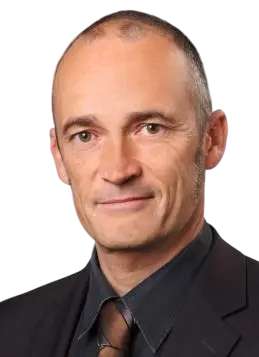
Last position:
Geoinformatics Specialist, Digitalization Expert at Luvent / GIZ
- Presentation of the potential of artificial intelligence for agriculture at the Pan-African Startup Conference in Algiers.
- Planning and delivery of the AI master class at the conference.
- Mentoring 10 startups to introduce innovative technologies into their products and services, including processing weather forecast data to create geo-localized, product-specific work instructions for farmers in Algeria.
Hayati T.

Last position:
Deputy Director General at Ministry of Environment, Urbanization and Climate Change - General Directorate of National GIS
Institutional Duties
- Meeting Institutional Geographic Data Demands
- Management of the Turkish National Geographic Data Infrastructure (TUCBS) Portal
- Coordination and Monitoring of Institutional GIS Projects
- Certification of Geographic Information System Expertise
- Legal Regulations on Geographic Information System
Personal Duties
- GIS Consultancy and Training
- Establishing a Geographic Business Intelligence Portal (Metabase BI - Fullstack)
- Establishing a Geographic Project Management Portal (Metabase BI-Fullstack)
- Geographic Information System Applications (Deep Learning with GeoPandas using QGIS-3.40, ArcGIS Pro 3.3, Python Libs: Keras, NumPY, SciPy, PyTorch)
- Establishing a National GIS Activities Evaluation System (Power BI - Client)
- Thesis Management of Geographic Information System Assistant Experts
Christopher S.

Last position:
Urban Heat Island (UHI) GIS analysis at Personal project
- Developed a GIS tool in Python to calculate and predict land surface temperature from spatial input variables from different sources, including remote sensing data.
- Implemented ETL pipelines and PostgreSQL with PostGIS.
Aghasaad H.
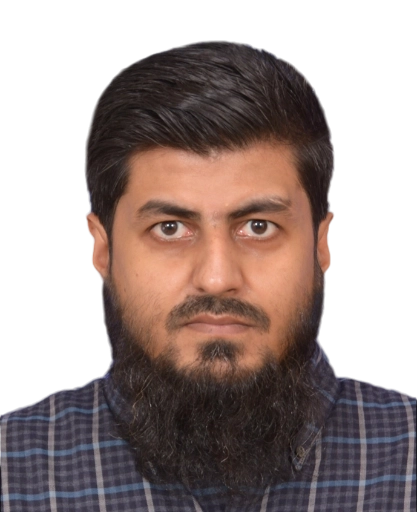
Last position:
ICT / Telecom Freelance Consultant at Freelance Consultant
- Completed 60+ projects focused on GIS tools optimization and RF planning and optimization, nominal planning, and coverage gap analysis using advanced tools and digital maps research and ASSET planning technical support and training.
- Latest projects: Brazil rural coverage gap analysis and planning using population density maps and advanced GIS and ASSET planning software.
- Identified top 25 to 30 locations in the country with enough population to propose a new site out of 95 000 on-air sites of all operators.
- Used advanced GIS tools to identify all locations suitable for a new site.
- Completed and submitted report and presentation in June 2022.
- Used GIS tools on Sentinel-2 multiband images for classification of landuse classes and generating usable maps for MYRIAD model and planning tools.
- Proposed optimal plan for Angola in phases 1–3 covering ICT systems and optimization of customer-provided plans.
- Adapted new technologies and tools.
- Planning tools: ASSET (predictions, coverage, statistics) and ASSET Design.
- Mapping tools: QGIS, Global Mapper, MapInfo Pro, Google Earth.
- Database: Oracle Enterprise on Windows and Linux.
- Reporting: MS Word, Excel, PowerPoint.
- Implemented AI/Machine Learning via Python in GIS maps.
Arnav S.
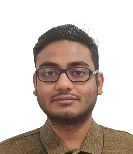
Last position:
Scientific Assistant (HIWI) at Institute of Transport and Automation Engineering, Production Technology Center, Leibniz University Hannover
- Implemented stereo camera calibration and applied incremental Structure from Motion (SfM) algorithms to build a detailed 3D model of a forklift for an AR-enabled Smart Forklift project
- Developed OpenCV-based preprocessing that improved data accuracy by 20% and enhanced the analysis of industrial videos
Mohammad Z.
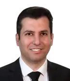
Last position:
Scientist & Project Manager (Data-Driven Climate Analytics) at Leibniz Institute for Agricultural Engineering (ATB)
- Developed AI-powered analytics tools for drought prediction using CMIP6 data.
- Integrated UAV and satellite imagery to optimize predictive models for drought resilience.
- Designed a Decision Support System (DSS) for integrated water resources management.
- Partnered with industry and research institutions to deliver environmental monitoring solutions.
- Managed international projects, aligning data science innovations with policy and business goals.
Experts recently working on similar projects
Freelancers with hands-on experience in comparable project as a Associate Professor in Geography


Marco V.



Dimitrios G.

Detlev N.
Sheraz K.
Georg H.
Badre A.

Navya S.

Eleftherios V.
Barbara B.

Sandra Z.
Nearby freelancers
Professionals working in or nearby Dhaka, Bangladesh
Dinmukhabet A.

Roman S.
Mansur Z.

Sergey F.
Hikmat S.
Khanim A.

Javid K.

Emin M.

Stephan L.

Beka C.